Skip to content
Vivid Maps Logo

  • Atlases
  • Map Posters
  • Scratch Maps
  • Globes
  • Videos
Fragile States IndexIndexesInternetPolitical mapsWorld
May 16, 2017 Alex

Fragile States Index (2017)

Indicators: Cohesion– Security Apparatus– Factionalized Elites– Group Grievance Economic– Economic Decline– Uneven Economic Development– Human Flight and Brain Drain Political–

Read More
CitiesMetro mapsTransport
May 15, 2017 Alex

Subway Maps compared to its real geography

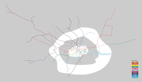
London Reddit user: Pham_Trinli   New York City Reddit user: playhouse_animation   Washington   Boston   Atlanta Reddit user: D3signAllTheThings

Read More
PopulationVivid maps
May 15, 2017 Alex

Population change by country (2000 – 2016)

Percent population change Population change by absolute numbers Changes in Population 10000 BCE to Present Source: www.vividmaps.com

Read More
Job
May 15, 2017 Alex

The Fastest Growing Job In Every U.S. State

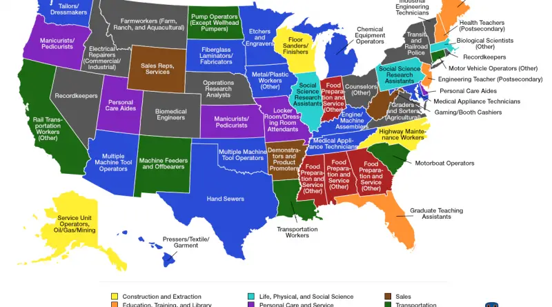
This is map illustrate the changes in regional labor markets by highlighting the highest fastest growing jobs (on a percentage

Read More
Demography
May 15, 2017 Alex

Countries by Population Density

Dive into the intriguing world of population density with our detailed world map and analysis. Learn about the most crowded and sparsely populated countries, and how this crucial metric shapes our global landscape.

Read More
World
May 15, 2017 Alex

Evangelical Population in the United States

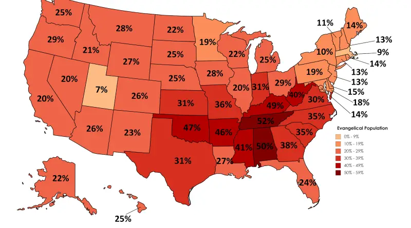
Reddit user: lursh123 Related post: – Mormons in the United States – Southern Baptists in the United States

Read More
Economic maps
May 15, 2017 Alex

What Does Each Asian Country Export the Most to the United States?

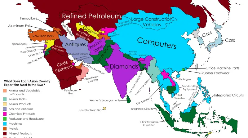
Reddit user: sendherhome22 Related post:  – What Does Each Country Export the Most to the United States?

Read More
CartogramsEntertainmentEnvironment mapsMapping StereotypesWage
May 14, 2017 Alex

Voting patterns in the Eurovision song contest (2017)

Cartogram showing the participating countries in the final of Eurovision Song Contest 2017 resized according to the total number of

Read More
MappingSubwayTransportVoronoi maps
May 14, 2017 Alex

London Tube Map with Voronoi, showing closest station for every location in the city

Source: bl.ocks.org Related posts: – Key bus routes in central London (with top tourist attractions) – London Traffic Counts Map –

Read More
Political maps
May 14, 2017 Alex

Distribution of American Presidents by the U.S. State of Birth

Since 1789, 44 men have served as president. George Washington was the first U.S. president. Grover Cleveland, the only president who worked two non-consecutive terms. (22nd and 24th president of the U.S.). There are currently four living former presidents.

Read More
Page 196 of 679« First«...102030...194195196197198...210220230...»Last »

Trending now

  • Mapped: Countries in which an official language is primarily written in a script developed within their modern-day borders
    Where Did Your Alphabet Really Come From?
  • Historical Maps of the United States and North America

Related Products

Push pin maps · Globe drinks cabinets · Maps of the United States · Board games · Monopoly · Map-based strategy board games · History Board Games · Coloring Books · Handheld GPS · GPS Watches · GPS Trackers

Vivid Maps Tools

· Convert Latitude/Longitude
· Elevation Finder
· Distance Calculator
· Kilometers to Miles Converter
· Kilograms to Pounds Converter
· Liters to Gallons Converter
· Temperature Converter
· Antipodes Map
· Find cities with a similar climate
· Find cities with a similar climate (2050)
· How hot cities could be in 2050
· The U.S. Population Lines

About
Privacy Policy

Copyright © 2026 Vivid Maps. All rights reserved.