
Antarctica Under the Ice
Antarctica’s ice reaches more than 4 kilometres in depth in places and covers 98% of the continent. Three maps show the bedrock terrain beneath it, the continent without ice, and the landscape that would eventually emerge after isostatic rebound. East Antarctica stays above sea level without ice. West Antarctica mostly does not.
Read more: Antarctica Under the IceRise & Fall of the Ottoman Empire
The Ottoman Empire, one of the most significant empires in history, had a long and complex rise and fall that spanned over six centuries.
Read more: Rise & Fall of the Ottoman Empire
How Islam Spread Across Three Continents in Just Over a Century
In 610 CE, Muhammad received his first revelation in a cave near Mecca, and within the lifetimes of just a few generations, the faith he founded had reached from Spain to the borders of India.
Read more: How Islam Spread Across Three Continents in Just Over a CenturyGermany mapped only by roads
Reddit user: gosnox
Read more: Germany mapped only by roadsCoast Lines
The total length of coastlines in the world as 1.16 million kilometres. Benjamin Hennig via geographical.co.uk
Read more: Coast Lines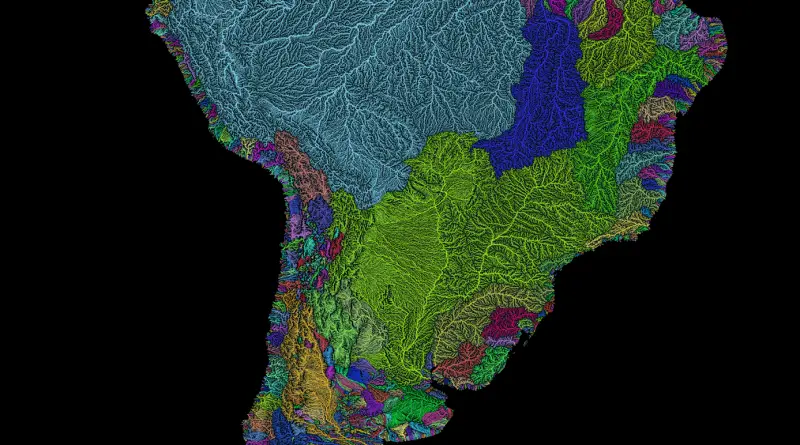
River basins of South America in rainbow colours
Via etsy.com Related posts: – River basins of Africa in rainbow colours – Rivers of Europe in rainbow colours –
Read more: River basins of South America in rainbow colours
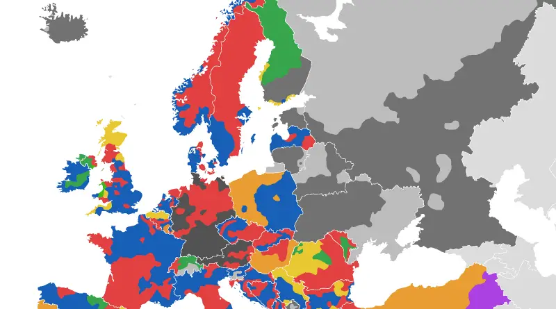
Voting Divisions in Europe (official color of dominant coalition/party shown)
Alexandr Trubetskoy (www.ispol.com) Related post: – Active separatist movements in Europe
Read more: Voting Divisions in Europe (official color of dominant coalition/party shown)Topographic map of Greenland from bedrock elevation data
Greenland is the world’s largest island and the least densely populated country in the world. It is located in the northern part of the North American continent, between the Arctic Ocean and the North Atlantic Ocean. Greenland is an autonomous territory of Denmark, with its own government and parliament.
Read more: Topographic map of Greenland from bedrock elevation data
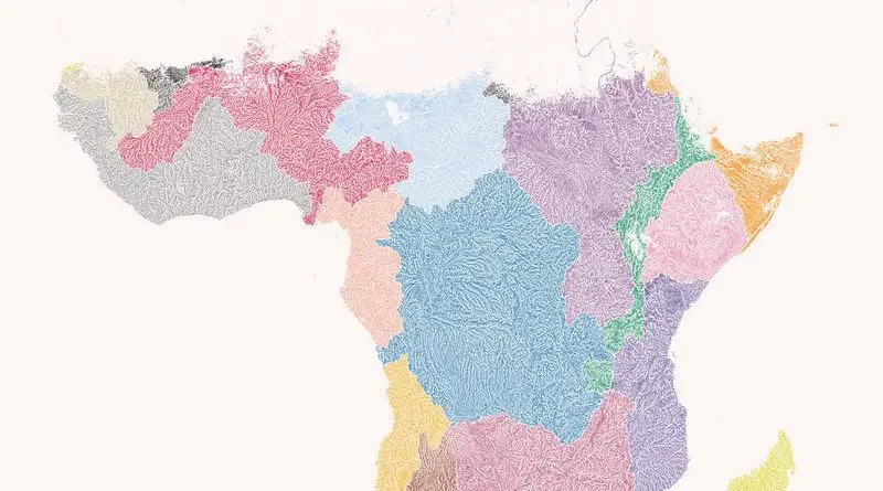
River basins of Africa
There are about 80 large rivers in Africa. Sixty-three are transboundary river basins covering about 64% of its land area and contain 93% of its total surface water resources. The largest river basins in Africa are Congo, Niger, Nile, the Senegal, Juba Shibeli, Lake Chad, Lake Turkana, Limpopo, Ogooue, Okavango, Orange, Volta, and Zambezi river.
Read more: River basins of Africa