


Random states of America
This interactive map creates randomly-generated state boundaries for the United States, and see who would recent presidential elections under the
Read More


This interactive map creates randomly-generated state boundaries for the United States, and see who would recent presidential elections under the
Read MoreThe precursor to the Russian Empire was the medieval state of Kievan Rus’, centered around Kiev (in present-day Ukraine). It was a loose federation of Slavic principalities that engaged in trade and cultural exchange with Byzantium and other European powers.
Read More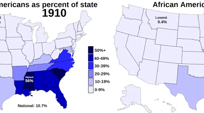
While no state has had an African American majority since 1930 (Mississippi dipped below 50% in 1940) the D.C. had
Read MoreThis exploratory map shows data from the fantastic Global Human Settlement Layer (GHSL) produced by the European Commission. Integrating huge
Read More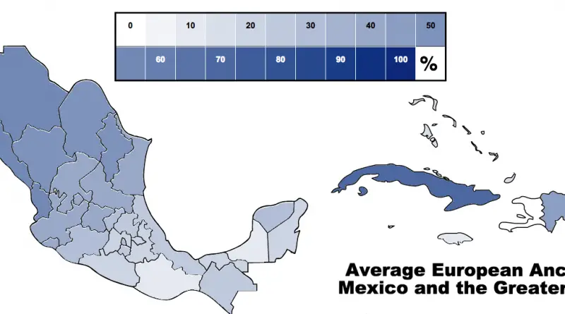
The U.S.-Mexico boundary stretched from the Gulf of Mexico in the east to the Pacific Ocean in the west. It is the most frequently passed boundary in the world, with around 350 million documented crossings yearly.
Read More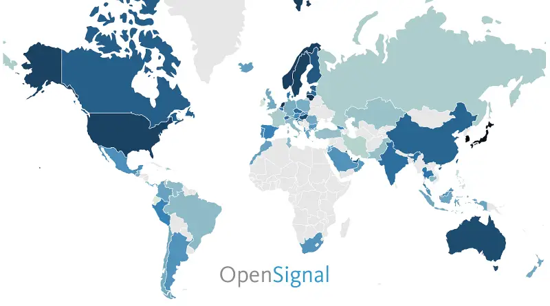
This map shows how consistently accessible 4G networks are in each country. Rather than measure geographic coverage, OpenSignal’s availability metric
Read More
The most popular baby names in the United States 2019 were Olivia for girls and Liam for boys, but how does the popularity of names differ within U.S. states?
Read More
The population density in Russia is just 8.4 per sq. km (22 people per sq. mi). The population is most dense in the European part of the country, with a milder climate, centering on Moscow and Saint Petersburg.
Read MoreAbbreviations: * = Dominion within the British Empire CR = Costa Rica Dom. Rep. = Dominican Republic FRCA = Federal
Read More