Percentate of pupils in general upper secondary education learning german
Via jakubmarian.com
Read MoreVia jakubmarian.com
Read More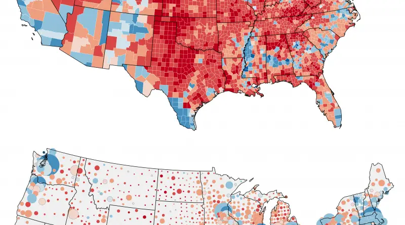
Related posts: – Change in margin between 2004 & 2016 elections – The power of small U.S. states – 3D
Read MoreThis video will show the history of the ancient Middle East from the arrival of humans to the fall of
Read MoreUnited States Presidential Election 2016 (County-Level Results) The winner of each county and his/her margin of victory is represented by
Read More
RenascentMan Methodology: Take the number of districts (2 fewer than the number of electors). Based on the reported vote percentages
Read More
The map shows operation renewable electricity sites over 0.01 MW. The area of circles represents installed capacity (maximum power output).
Read MoreCurrently, the allocations of Electoral Votes are based on the 2010 Census. They are valid for the 2012, 2016, and 2020 presidential elections (Total Electoral Votes: 538; Electoral Votes needed to win 270). California has the most electoral seats (55) of any U.S. state, while Texas places 2nd with 38 seats. New York and Florida each have 29 seats, while Pennsylvania and Illinois have 20 seats per state.
Read More