Afro-American Travel Map (1942)
A guide for negro hotels and guest houses in the eastern USA.
Read MoreA guide for negro hotels and guest houses in the eastern USA.
Read More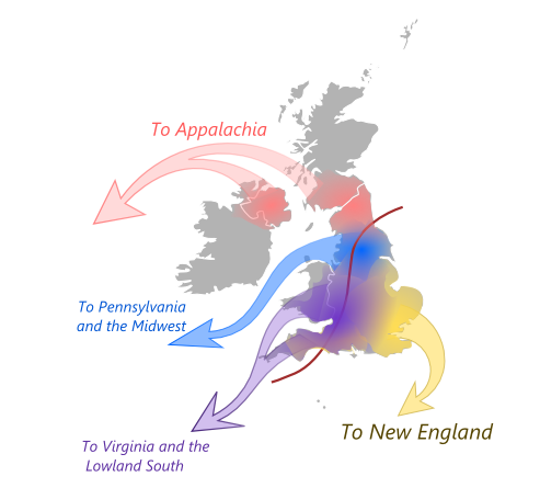
Massachusetts doesn’t feel like Virginia for a reason. Between 1620 and 1770, four British regions sent settlers with completely different worldviews. East Anglian Puritans built communal New England. North Midlands Quakers created tolerant Pennsylvania. Southern English gentry ran hierarchical Virginia. Scottish-English borderers settled independent Appalachia. The map shows where they came from and where they went. American regions still reflect those origins.
Read MoreAccording to seattletimes.com Among the 50 biggest U.S. cities, Seattle ranks No. 3 on the “geographic diversity index” with a
Read More