Dubbing TV and Film in Europe
From Spain’s full dubbing tradition to Scandinavia’s subtitle culture – here’s how European countries handle foreign TV shows and movies differently.”
Read more: Dubbing TV and Film in Europe
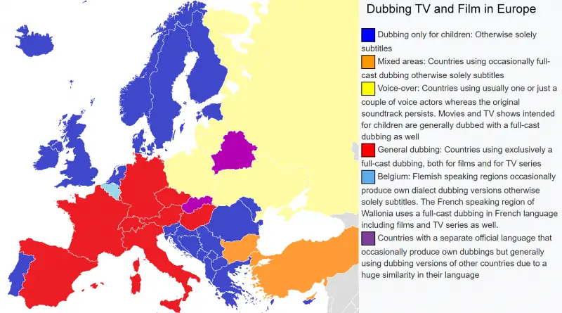
From Spain’s full dubbing tradition to Scandinavia’s subtitle culture – here’s how European countries handle foreign TV shows and movies differently.”
Read more: Dubbing TV and Film in Europe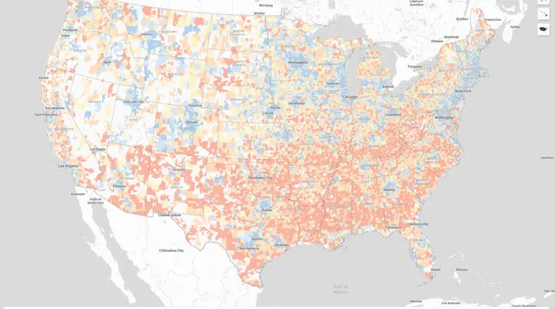
From Mississippi to Utah, new research maps America’s economic disparities. See how your state ranks and why some communities flourish while others fall behind.
Read more: Great Divide: Understanding America’s Distressed Communities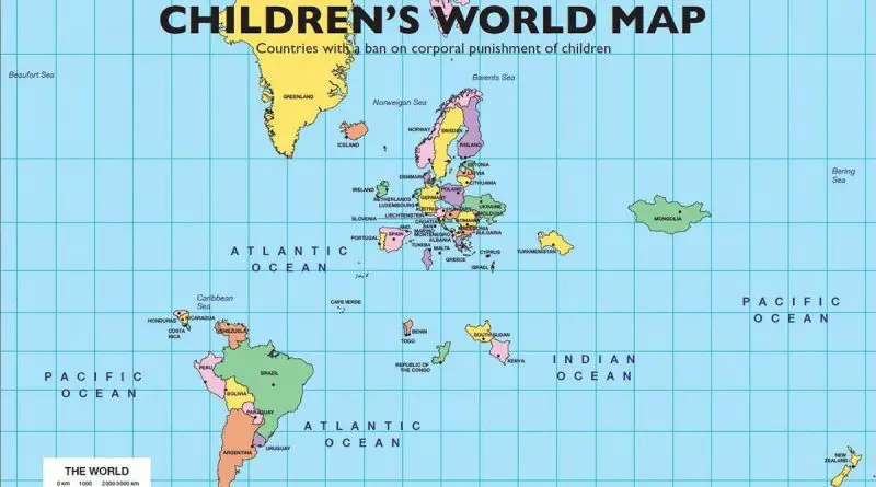
Seventy states have banned all corporal punishment of children, home included.
Read more: Countries With a Ban on Corporal Punishment of Children, Mapped
A sobering look at nuclear weapons’ destructive power, comparing the Fat Man bomb’s blast zones to contemporary cities worldwide, with detailed analysis of potential damage zones and historical context from World War II.
Read more: Blast Radius of the Fat Man Nuclear Bomb Transposed to other Major World Cities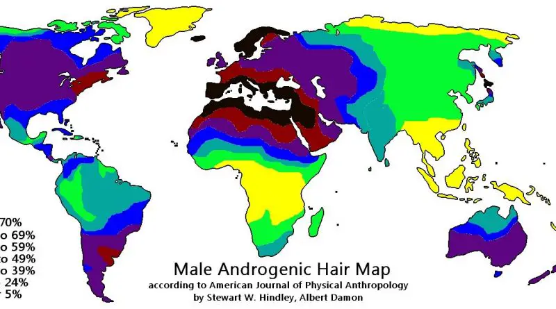
Androgenic (body) hair is the terminal hair that grows on the body beginning to puberty period. It is distinguished from the head hair and less noticeable vellus hair that is much finer and lighter in color. The growth of androgenic hair is linked to androgens’ level and the density of androgen receptors in mesenchymal cells in the skin.
Read more: Average Body Hair Distributions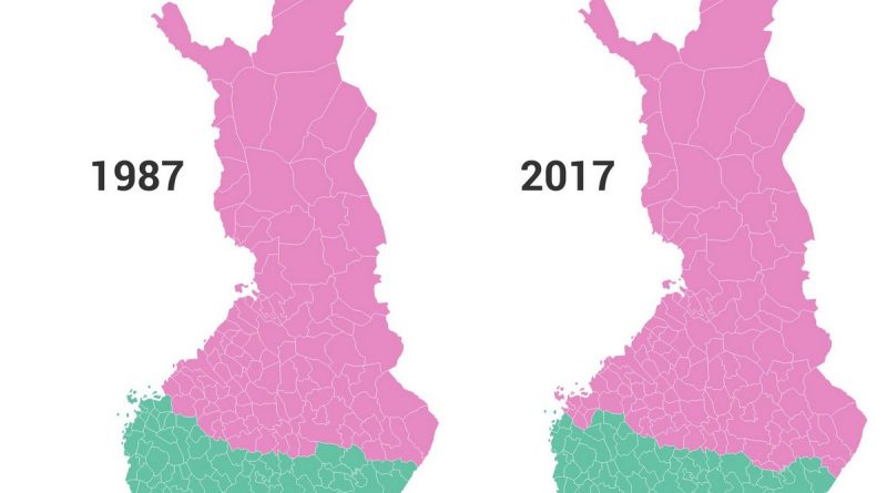
Examine Finland’s remarkable population shift through unique maps showing how Helsinki grew from housing 15% to 28% of Finns between 1987-2017, while northern regions adapted to maintain their share of the population in a smaller area.
Read more: How Finland’s Population Shifted: A Tale of Two Decades (1987-2017)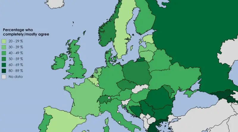
Recent research reveals fascinating patterns in how Europeans view their cultural heritage, with Eastern European nations showing remarkably strong cultural pride. Find out which countries rank highest and what drives these differences.
Read more: Cultural Pride Across Europe Mapped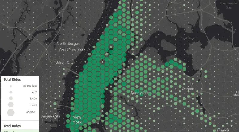
An interactive visualization of over 130 million NYC yellow taxi rides reveals fascinating patterns about how New Yorkers use cabs, from popular pickup spots to tipping behavior across different neighborhoods.
Read more: NYC Cab Rides Map: A Data-Driven Look at New York City’s Yellow Taxi Patterns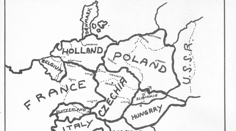
A Newark businessman’s 1941 book included a shocking map that divided Germany among neighboring countries. The Nazis turned this obscure proposal into powerful propaganda.
Read more: The 1941 Map That Proposed Erasing Germany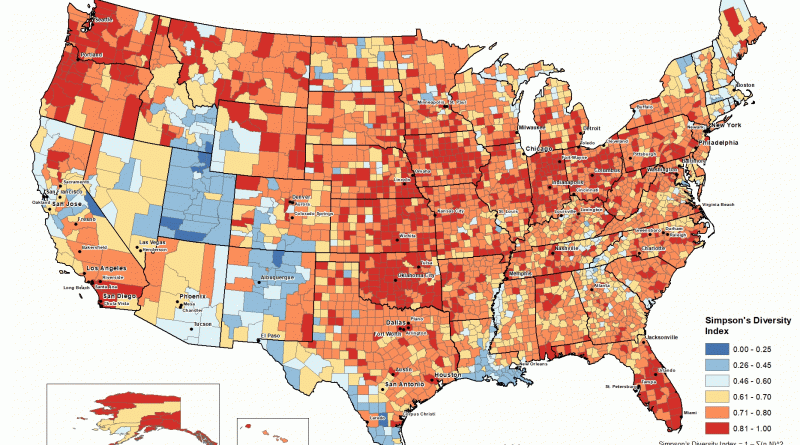
Follow the fascinating transformation of America’s religious landscape through detailed county-level maps spanning 120 years. Using historical data and modern visualization techniques, these maps reveal the changing patterns of religious diversity across the United States.
Read more: Religious Diversity Across America: A 120-Year Journey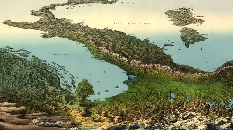
An extraordinary 19th-century panoramic illustration presents Italy from an impossible vantage point – as if viewed from high above the Alps, with the entire peninsula and Mediterranean Sea stretching toward the African continent.
Read more: A Bird’s Eye View of Italy: The Alps-to-Africa Panorama from the 1850s
China’s metro development story is remarkable – from Beijing’s first line in 1969 to becoming home to the world’s longest subway networks. Here’s how it happened..
Read more: The Evolution of Metros in China and Taiwan (1990 – 2020): A 30-Year Transportation Revolution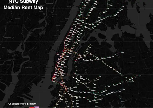
Taking a closer look at how New York City’s subway system shapes rental prices across neighborhoods, revealing unexpected patterns and money-saving opportunities for those willing to walk a few extra blocks.
Read more: The NYC Subway Rental Map