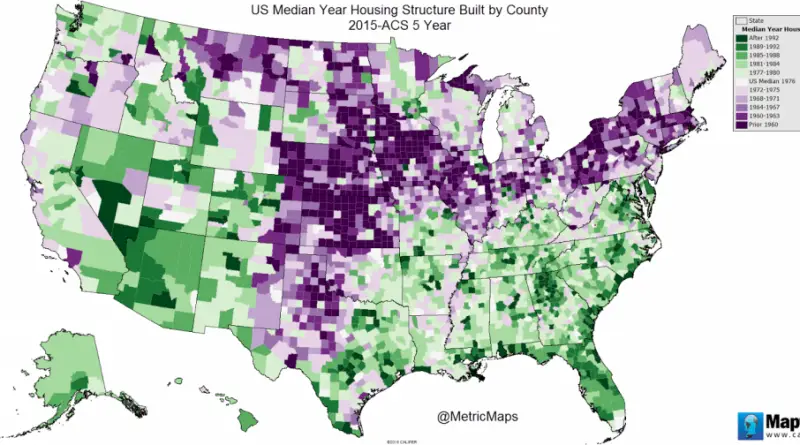
U.S. Housing Units Built by Era (1940 – 2009)
The U.S. states with the oldest housing – % built before 1960 New York – 56.5% (Median year built: 1956)
Read more: U.S. Housing Units Built by Era (1940 – 2009)
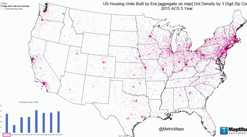
The U.S. states with the oldest housing – % built before 1960 New York – 56.5% (Median year built: 1956)
Read more: U.S. Housing Units Built by Era (1940 – 2009)This 3D web map allows users to learn more about the Morningside Heights Historic District, which the New York City
Read more: Morningside Heights Historic District ExplorerEach pin shows how much you’d need to earn per hour to rent in that postcode (based on a single
Read more: The hourly salary needed to rent in BritainThis 3D web map allows users to learn more about the Morningside Heights Historic District, which the New York City
Read more: Morningside Heights Historic District ExplorerPBDB Navigator allows users to explore the Paleobiology Database through space, time, and taxonomy. interactive map visualizing the data allows
Read more: Where are your nearest dinosaurs?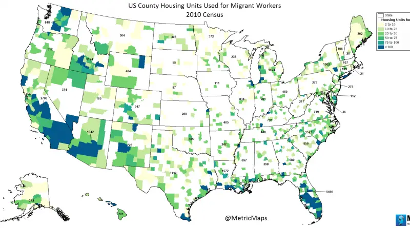
www.metricmaps.org/2017/03/02/us-county-housing-units-used-for-migrant-workers
Read more: U.S. County Housing Units Used for Migrant Workers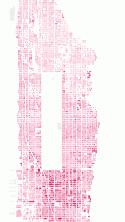
Building Height in Manhattan New York City has over 6 thousand high-rise buildings in total, 274 of which are skyscrapers
Read more: Building heights of ManhattanExperience lower Manhattan in a whole new way with a new interactive 3D map. Related posts: – How tall will new
Read more: Manhattan in 3DThe Atlas of ReUrbanism is a tool to understand, support, and transform American cities. Developed by the Preservation Green Lab,
Read more: The Atlas of ReUrbanismBy 2030, over 90% of the UK population will live in urban areas. It’s more important than ever to understand
Read more: Glasgow in Motion: Explore where people walk, run, and cycle in Scotland’s largest city
Citizens Housing & Planning Council (CHPC) has undertaken an analysis of New York City’s people and housing to reveal changes
Read more: The Changing Face of New York City (2000 – 2010)