Ethnic maps

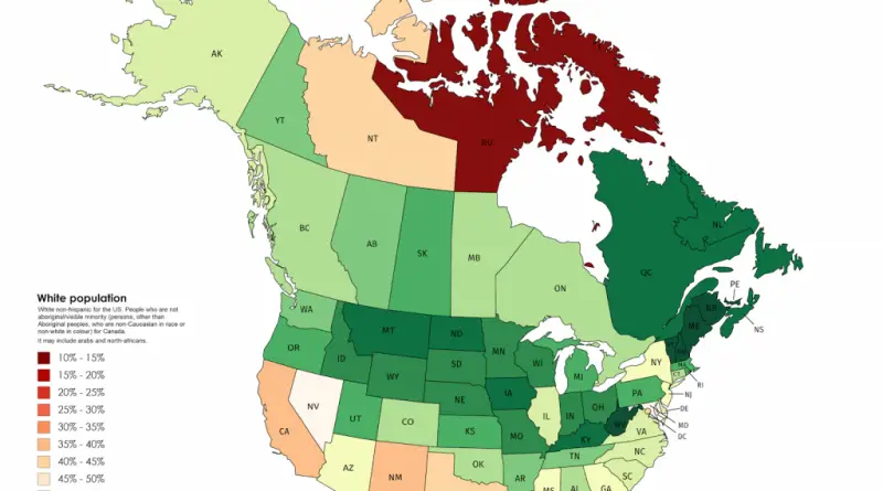
Where the largest shares of people identifying as white still live in Canada and the United States

New Brunswick 90.16%, Vermont 89.3%, West Virginia 89.14%. Atlantic Canadian provinces and rural American states have the highest white population shares in North America. Post-1970s immigration concentrated in Toronto, Vancouver, and major U.S. gateway cities, leaving these regions demographically unchanged.

Read more: Where the largest shares of people identifying as white still live in Canada and the United States
Transport

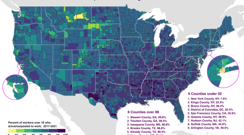
Mapping America’s Car Dependency by County

In Stewart County, Georgia, 99.6% of workers drive to their jobs. In Manhattan, just 7.6% do. This map using Census Bureau data from 2017-2021 shows which American counties are most car-dependent and where alternatives exist. Eight counties exceed 98% driving rates, all in rural areas. Nine counties fall below 50%, concentrated in dense urban centers with transit systems.

Read more: Mapping America’s Car Dependency by County