Skip to content
VividMaps

  • Atlases
  • Map Posters
  • Scratch Maps
  • Globes
  • Videos
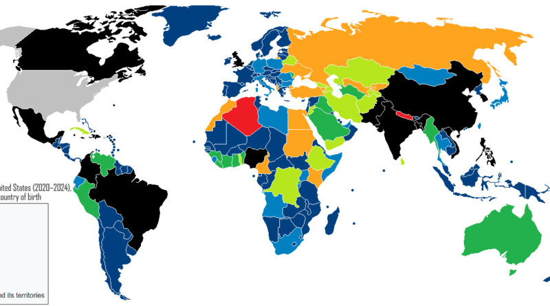
World map of New Immigrants to the United States (2020-2024) in diversity category, by country of birth
Immigration
November 2, 2017 Alex

America’s Green Card Lottery Began as a Favor to Ireland

How the Diversity Visa program started, who actually wins it today.

Read more: America’s Green Card Lottery Began as a Favor to Ireland →

The most dangerous cities worldwide
CitiesCrime maps
October 31, 2017 Alex

Which Cities Have the Highest Homicide Rates?

Colima, Mexico, leads a list of 49 cities at 181.94 homicides per 100,000 residents.

Read more: Which Cities Have the Highest Homicide Rates? →
Mainline protestants by U.S. county mapped
Animated mapsMaps of World ReligionsVivid maps
October 31, 2017 Alex

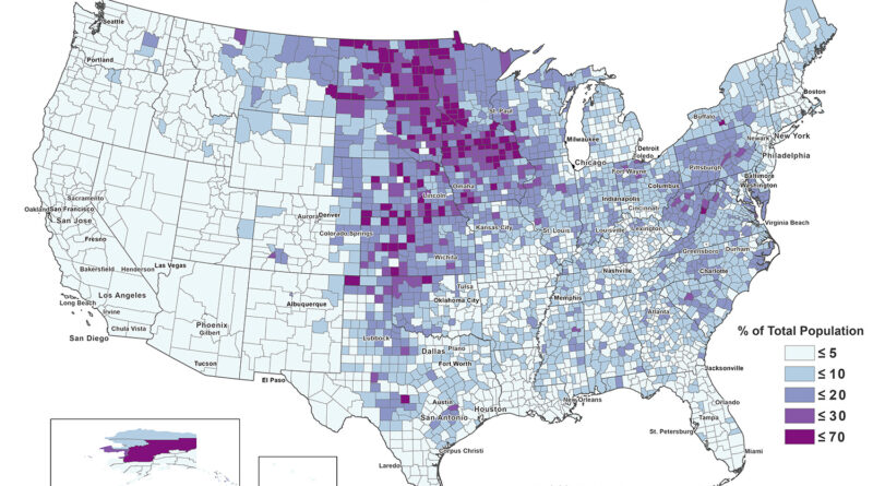
Mainline Protestant Population by State and County

Nelson County, North Dakota recorded the highest Mainline Protestant share of any US county in 2020, at 69.45 percent. The next nine counties on the list are in North Dakota, Minnesota, Iowa, and South Dakota.

Read more: Mainline Protestant Population by State and County →
Food
October 31, 2017 Alex

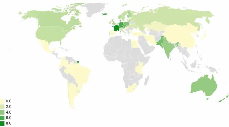
Which Countries Eat the Most Butter Per Person?

From Denmark’s 8.55 kg (18.8 lb) a head to India’s 4,976 kt total, here is who eats the most butter, why, and what research says about it.

Read more: Which Countries Eat the Most Butter Per Person? →
Climate
October 31, 2017 Alex

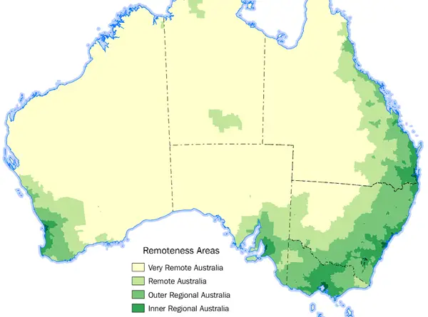
Remoteness of Australia

Five remoteness classes cover Australia, and 73% of residents live in Major Cities. The dry centre is empty because of climate, and the rainy north because of cyclones, poor soils and distance.

Read more: Remoteness of Australia →
Historical Maps
October 30, 2017 Alex

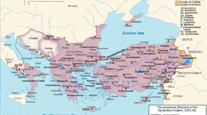
The Byzantine Empire at its Heyday (1025AD)

Basil II died in December 1025 while planning to retake Sicily. The empire he left behind reached from southern Italy to the Caucasus.

Read more: The Byzantine Empire at its Heyday (1025AD) →
Languages of Europe around 600 AD
Historical Maps
October 30, 2017 Alex

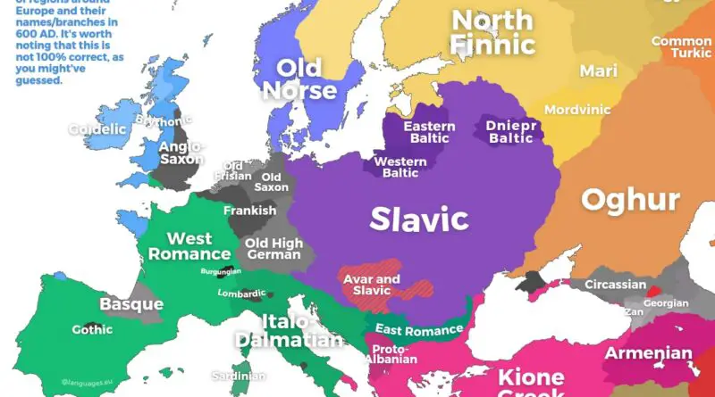
Map of Europe in 600 AD

A Roman monk was working on a pagan king in Kent while Avars and Slavs pressed the Byzantine frontier. A quick look at Europe in 600 AD.

Read more: Map of Europe in 600 AD →
Languages
October 29, 2017 Alex

Which Languages Do Europeans Speak Besides Their Own?

Nearly half of EU residents speak English as a foreign language, while the other major languages stay close to home.

Read more: Which Languages Do Europeans Speak Besides Their Own? →
Interactive mapsReal estate
October 26, 2017 Alex

Mapping San Francisco Building Ages

San Francisco has the third-oldest housing of the 100 largest U.S. counties. A parcel-level map by Danny Yang shows where the oldest buildings are.

Read more: Mapping San Francisco Building Ages →
Ethnic mapsNews
October 24, 2017 Alex

The Peoples of China

The Han Chinese are the largest ethnic group in China, covering about 92 per cent of its mainland population. Other

Read more: The Peoples of China →
Orthodox Christian Population by U.S. state in 2020 mapped
Maps of World ReligionsVivid maps
October 24, 2017 Alex

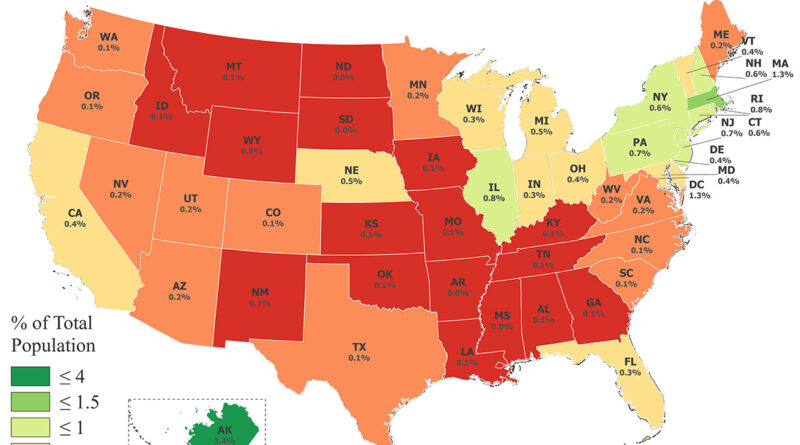
Orthodox Christian Population by County and State

Eight of the ten US counties with the highest Orthodox Christian share in 2020 are in Alaska, led by Lake and Peninsula Borough at 44.92 percent. Davidson County, Tennessee and Lake County, Indiana complete the list.

Read more: Orthodox Christian Population by County and State →
Entertainment
October 24, 2017 Alex

Ludacris’s Area Codes Song, Mapped Across the U.S.

Ludacris named 43 U.S. area codes in his 2001 hit. Mapped out, they follow the East Coast and the South, with six in the Far West and none in the Rocky Mountain states.

Read more: Ludacris’s Area Codes Song, Mapped Across the U.S. →
Energy
October 23, 2017 Alex

Map shows the average cost of electricity per U.S. state

A kilowatt-hour costs about four times more in Hawaii than in Nevada, and prices moved in different directions this year.

Read more: Map shows the average cost of electricity per U.S. state →
Page 108 of 521« First«...104105106107108109110111112...»Last »

Trending now

  • Human races of the 19th century
    How Has Our View of Human Diversity Changed Since the 19th Century?Oct 22, 2017
  • Maps of differences between East and West Germany
    Germany is still divided by east and westSep 11, 2020
  • Soviet detailed map
    Detailed Cold War-era Soviet military map of the San Francisco Bay area (1980)Oct 22, 2017

Related Products

  • Push pin maps
  • Globe drinks cabinets
  • Maps of the United States
  • Board games
  • Monopoly
  • Map-based strategy board games
  • History Board Games
  • Coloring Books
  • Handheld GPS
  • GPS Watches
  • GPS Trackers

Vivid Maps Tools

  • Convert Latitude/Longitude
  • Elevation Finder
  • Distance Calculator
  • Kilometers to Miles Distance & Length Converter
  • Weight Converter
  • Volume Converter
  • Daylight Comparison
  • Time Zone Converter
  • Antipodes Map
  • Find cities with a similar climate
  • Find cities with a similar climate (2050)
  • How hot cities could be in 2050
  • The U.S. Population Lines

Stay connected

Get the latest maps, insights and updates delivered to your inbox.

Unsubscribe anytime.

VividMaps

Maps that explain the world.

Beautiful, data-rich maps to help you understand our world — its people, places and connections.

Explore

World map World atlas Map posters Globes

Company

About Privacy Contact

Stay connected

Follow us for the latest maps, insights and updates.

Independent WebsiteVirusScanner trust report for vividmaps.com
© 2026 Vivid Maps. All rights reserved.
A more connected world