Population access & estimated visitation on eclipse day
On August 21, 2017, a total solar eclipse crosses the United States from Oregon to South Carolina. The closest destinations
Read MoreOn August 21, 2017, a total solar eclipse crosses the United States from Oregon to South Carolina. The closest destinations
Read MoreChange in USD exchange rate (%) Japan 19.3 New Zealand 5.3 Indonesia 0.9 Czech Republic 0.4 Kuwait 0.2 United States
Read MoreBelow the 3D Europe population density maps.
Read More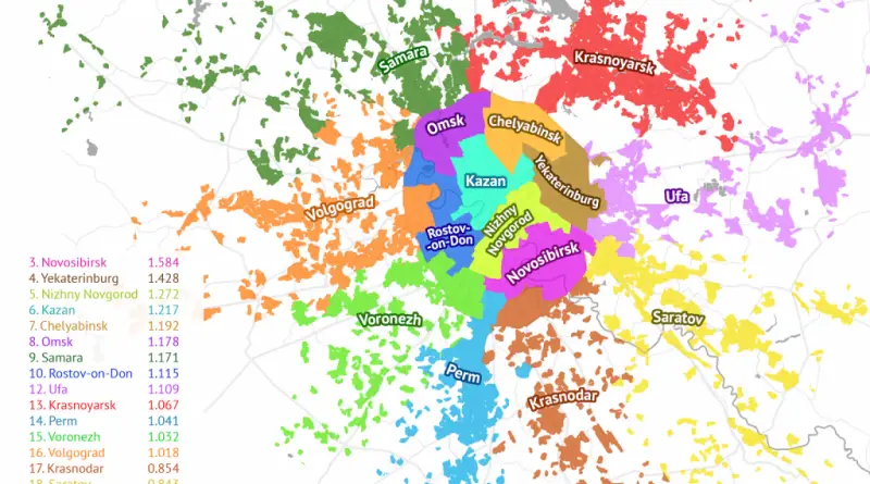
Russian cities whose populations fit inside the Moscow metro area. Source: sashat.me
Read More
Dogs were the first domesticated animals. They have accompanied humans for about 30,000 years. Scientists generally acknowledge that all dogs share a common wolf ancestor. Nowadays, humans have bred hundreds of various domestic dog breeds. The maps below show dogs of the world and their nations of origin.
Read MoreThe ice age is a long period of decrease in our planet’s surface and atmosphere temperature, resulting in the growth of continental and polar ice sheets and mountain glaciers. During the last ice age about one-third of the Earth’s surface was covered by ice.
Read More
Reddit user: mapsturbater
Read More