Traffic Index for Country 2016
Traffic on roads may consist of pedestrians, ridden or herded animals, vehicles, streetcars, buses and other conveyances, either singly or
Read more: Traffic Index for Country 2016
Traffic on roads may consist of pedestrians, ridden or herded animals, vehicles, streetcars, buses and other conveyances, either singly or
Read more: Traffic Index for Country 20161. The fastest growing cities are all in the south, the shrinking ones are all in the north 2. That’s
Read more: 14 maps and charts which show England’s north south divide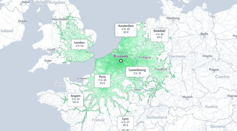
Brussels was no accident as Europe’s political capital. It lies right at the geographic centre of the continent, and an animated rail map makes that clearer than any political speech. Paris in under 3 hours, Amsterdam the same. London in just over 4. By hour 8, the network reaches from Hamburg to Marseille and from the Atlantic to Berlin.
Read more: Eight Hours from Brussels by Train, and Where You End UpThe forest composition across Canada varies widely due to the country’s vast size, diverse geography, and range of climatic conditions. Canada boasts one of the largest forested areas in the world, covering approximately 347 million hectares, which is about 9% of the world’s forested land.
Read more: Forest composition across CanadaA map of Martian gravity looking down on the North Pole (White and red are areas of higher gravity; blue
Read more: New Gravity Map of MarsRelated posts: – How to say ‘Yes’ in Europe
Read more: How to say ‘yes’ in Southeast Asia