
Earth’s long-term warming trend (1880 – 2015)
This visualization illustrates Earth’s long-term warming trend, showing temperature changes from 1880 to 2015 as a rolling five-year average. Orange
Read more: Earth’s long-term warming trend (1880 – 2015)Mapping US drug overdoses
Deaths from overdoses are reaching levels similar to the H.I.V. epidemic at its peak. The death rate from drug overdoses
Read more: Mapping US drug overdoses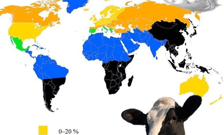
Lactose intolerance by percent of the population
Lactose intolerance is an impaired ability to digest lactose, a sugar found in dairy products. Only one-third of people produce the lactose enzyme during adulthood, which enables them to drink milk.
Read more: Lactose intolerance by percent of the populationGlobal temperature anomalies of 2015
2015 was hottest year in recorded history.
Read more: Global temperature anomalies of 2015World map of economic growth
Predicted growth rate (%) annually to 2024.
Read more: World map of economic growthShipping lanes mapped
The busiest ship traffic areas in the world are typically concentrated around major ports, waterways, and strategic maritime routes. The map below shows areas that experience high volumes of vessels, ranging from cargo ships and tankers to cruise liners and fishing boats.
Read more: Shipping lanes mapped
The best and worst films of each country in Europe according to IMDB
The best film of each country in Europe The worst film of each country in Europe
Read more: The best and worst films of each country in Europe according to IMDB