World Maps of the Stereotypes
Atlas of the maps below illustrates stereotypes, providing an impression of how particular regions of the world view others.
Read More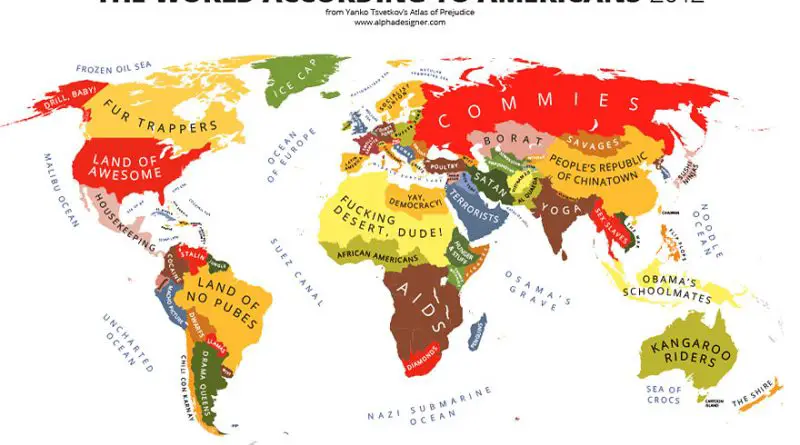
Atlas of the maps below illustrates stereotypes, providing an impression of how particular regions of the world view others.
Read More
German cultural influence remains evident in the architecture, traditions, and historical landmarks found in various parts of eastern Europe. The shared history of German settlements in the region has shaped the multicultural tapestry of Europe, contributing to the complex and interconnected nature of the continent’s history.
Read MoreSunlight duration in hours per year in the continental United States and Europe. Related posts: – Annual sunshine hours map of
Read More
Los Angeles County is the first in the country to reach 10 million inhabitants. If the Los Angeles five-county area were a state, it would exceed all states in total population size except California, Texas, New York, and Florida. The County of Los Angeles alone would be the 7th most populated state.
Read More

Reddit user: trinitronbx
Read More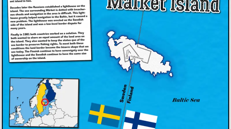
Märket Island is a small, unique island located in the Baltic Sea, between Sweden and Finland. The island is split in half, with its western part belonging to Sweden and its eastern part to Finland. This division is a result of a land swap agreement between Sweden and Russia (which controlled Finland) in the 19th century. Märket Island is particularly famous for its shared lighthouse, where the kitchen and living room are in Sweden, and the bedrooms are in Finland. This arrangement reflects the peaceful coexistence and cooperation between the two countries despite the island’s unusual border.
Read MoreReddit user: trinitronbx
Read MoreBorders of the European countries before the Great War (1915) Borders of the European countries after the Great War (1920)
Read More