Skip to content
VividMaps

  • Atlases
  • Map Posters
  • Scratch Maps
  • Globes
  • Videos
ImmigrationReal estate
March 3, 2017 Alex

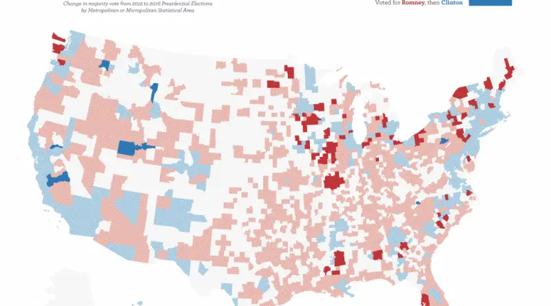
U.S. County Housing Units Used for Migrant Workers

www.metricmaps.org/2017/03/02/us-county-housing-units-used-for-migrant-workers

Read more: U.S. County Housing Units Used for Migrant Workers →

Political maps
March 3, 2017 Alex

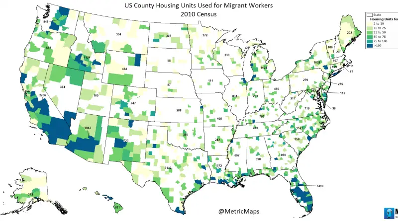
Moving toward Trump

Change in majority vote from 2012 to 2016 Presidential Elections by Metropolitan or Micropolitan Statistical Area. 80 cities that flipped

Read more: Moving toward Trump →
Maps of World Religions
March 3, 2017 Alex

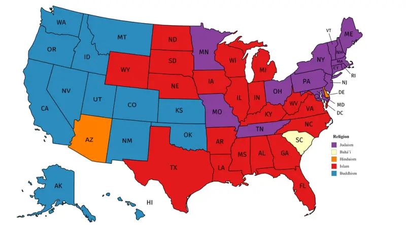
Largest non-Christian religion in each U.S. state

Source: Reddit / user: Jedicobra Related posts: – Overall religiosity by U.S. State – Catholic Ecclesiastical Provinces in the United

Read more: Largest non-Christian religion in each U.S. state →
Mapping StereotypesPolitical mapsWorld
March 3, 2017 Alex

World of freedom in 2017

Freedom in the World 2017 evaluates the state of freedom in 195 countries and 14 territories during the calendar year

Read more: World of freedom in 2017 →

Dublin in 1000 AD mapped
Animated mapsHistorical Maps
March 2, 2017 Alex

History of Dublin Mapped

There is an archaeological discussion regarding where and when Dublin formed, with a settlement founded by the Gaels during or before the 7th century Common Era.

Read more: History of Dublin Mapped →
Weather
March 2, 2017 Alex

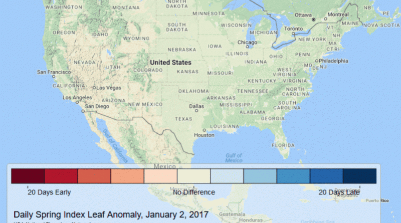
Spring Has Sprung Early

Spring is arriving very early this year . . . at least 2-3 weeks early across almost the entire Southeast,

Read more: Spring Has Sprung Early →
Environment mapsNatureOld maps
March 2, 2017 Alex

U.S. Vegetation Map (1970)

Detailed vegetation map in The National Atlas of the United States of America (USGS, 1970, Gerlach).  This 1:7,500,000-scale map, in

Read more: U.S. Vegetation Map (1970) →
Economic maps
March 1, 2017 Alex

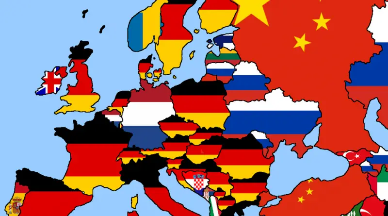
European Countries by Top Import & Export Partner

Each country’s top import partner Each country top export partner

Read more: European Countries by Top Import & Export Partner →
BusinessEconomic mapsMapping Stereotypes
March 1, 2017 Alex

European billionaires

The number of US$ billionaires in European countries. European billionaires per 10 million people European billionaires per 1 million people

Read more: European billionaires →
Real estate
March 1, 2017 Alex

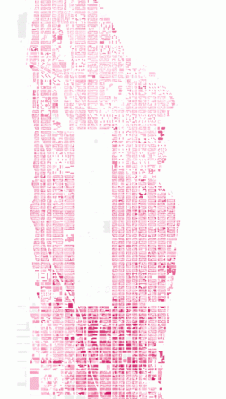
Building heights of Manhattan

Building Height in Manhattan New York City has over 6 thousand high-rise buildings in total, 274 of which are skyscrapers

Read more: Building heights of Manhattan →
CarsClimate ChangeVideo
March 1, 2017 Alex

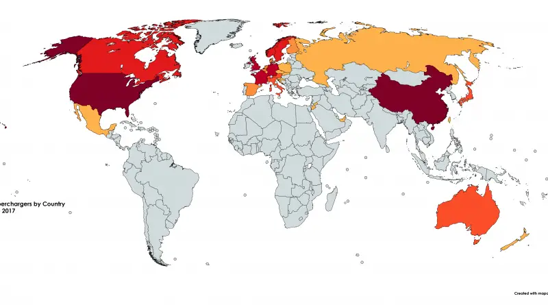
Tesla Superchargers by Country (28 February 2017)

Read more: Tesla Superchargers by Country (28 February 2017) →
AgricultureHistorical MapsMapping Stereotypes
March 1, 2017 Alex

U.S. States that have been partially or completely owned by Spain in the past

Read more: U.S. States that have been partially or completely owned by Spain in the past →
Mapping StereotypesVideo
March 1, 2017 Alex

The world according to the Dutch

Reddit user: Inspirationguy

Read more: The world according to the Dutch →
Page 180 of 521« First«...176177178179180181182183184...»Last »

Trending now

  • Soviet detailed map
    Detailed Cold War-era Soviet military map of the San Francisco Bay area (1980)Oct 22, 2017
  • World map of Y-DNA Haplogroups
    World map of Y-DNA HaplogroupsMay 17, 2017
  • Maps of differences between East and West Germany
    Germany is still divided by east and westSep 11, 2020

Related Products

  • Push pin maps
  • Globe drinks cabinets
  • Maps of the United States
  • Board games
  • Monopoly
  • Map-based strategy board games
  • History Board Games
  • Coloring Books
  • Handheld GPS
  • GPS Watches
  • GPS Trackers

Vivid Maps Tools

  • Convert Latitude/Longitude
  • Elevation Finder
  • Distance Calculator
  • Kilometers to Miles Distance & Length Converter
  • Weight Converter
  • Volume Converter
  • Daylight Comparison
  • Time Zone Converter
  • Antipodes Map
  • Find cities with a similar climate
  • Find cities with a similar climate (2050)
  • How hot cities could be in 2050
  • The U.S. Population Lines

Stay connected

Get the latest maps, insights and updates delivered to your inbox.

Unsubscribe anytime.

VividMaps

Maps that explain the world.

Beautiful, data-rich maps to help you understand our world — its people, places and connections.

Explore

World map World atlas Map posters Globes

Company

About Privacy Contact

Stay connected

Follow us for the latest maps, insights and updates.

Independent WebsiteVirusScanner trust report for vividmaps.com
© 2026 Vivid Maps. All rights reserved.
A more connected world