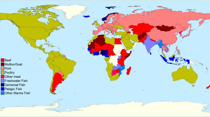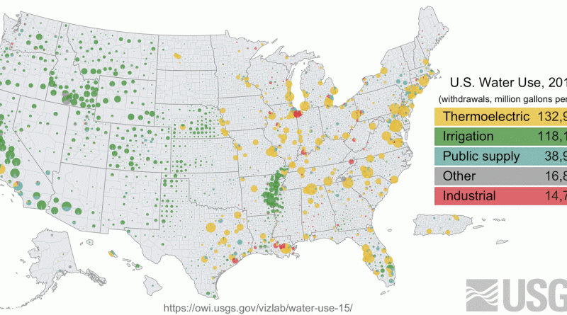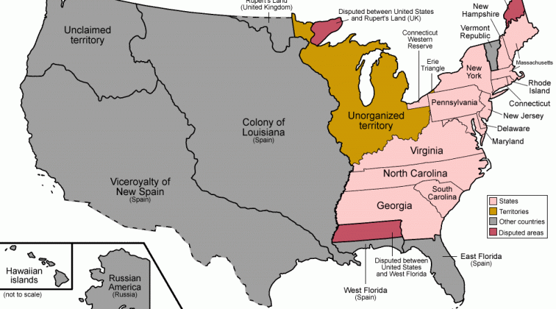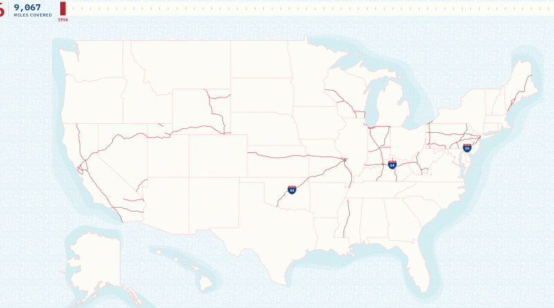
The Evolution of the U.S. Interstate Highway System: A Network That Shaped America
President Eisenhower’s ambitious 1956 highway project revolutionized American transportation, growing from initial plans for 41,000 miles to today’s extensive 49,055-mile network. Through historic maps and modern visualizations, we trace this remarkable transformation.
Read More