Skip to content
VividMaps

  • Atlases
  • Map Posters
  • Scratch Maps
  • Globes
  • Videos
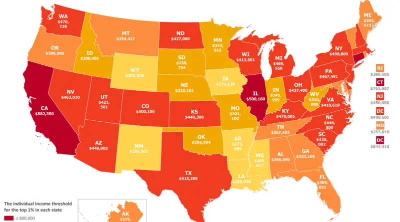
Mapped: What does it take to join the top 1% of income earners in the United States?
Economic mapsNewsVivid maps
January 24, 2025 Alex

Breaking Into the Top 1%: How Income Thresholds Vary Across the USA

A deep dive into the financial landscape of America’s top earners, revealing the surprising income levels required to join the top 1% in different states and at various stages of life.

Read more: Breaking Into the Top 1%: How Income Thresholds Vary Across the USA →
Map of Japan in 1603
Historical Maps
January 16, 2025 Alex

Japan in 1603: A Map of Clans and the Birth of the Tokugawa Shogunate

A fascinating 1603 map of Japan shows the emblems of major clans at the dawn of the Tokugawa Shogunate. Discover how Japan transitioned from a fractured collection of warring states to a unified nation under Tokugawa Ieyasu.

Read more: Japan in 1603: A Map of Clans and the Birth of the Tokugawa Shogunate →
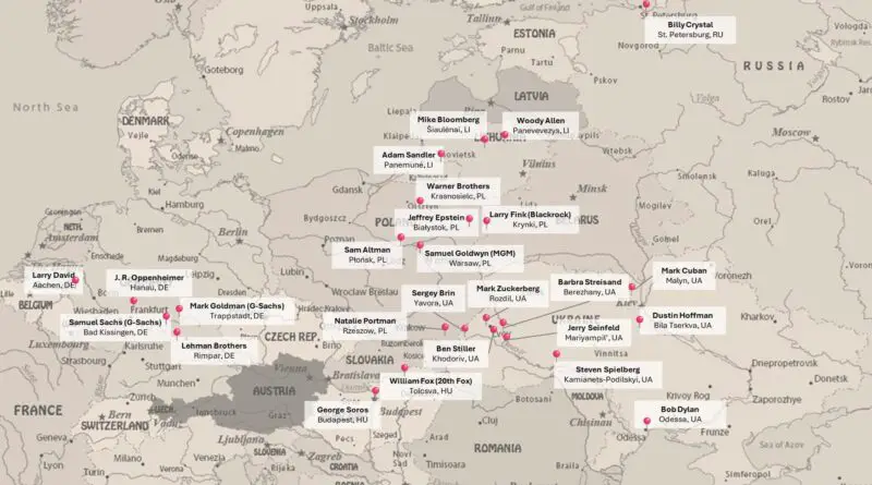
Famous Ashkenazi Jewish Americans mapped
Ethnic maps
January 14, 2025 Alex

From Shtetl to Silicon Valley: Mapping Jewish American Success Stories

From Warsaw to Budapest, trace the ancestral origins of prominent Jewish American figures who transformed entertainment, technology, and finance. Their family journeys from Eastern Europe to America tell a remarkable story of innovation and achievement.

Read more: From Shtetl to Silicon Valley: Mapping Jewish American Success Stories →
Mars terrain
NewsPolitical mapsSpaceVivid maps
January 13, 2025 Alex

Space Race 2024: Mapping Election Results on Mars and Moon

What if election results shaped other worlds? See how Trump’s votes create Mars-like peaks and valleys, while Harris’s support carves the lunar surface – revealing Earth’s political divide through planetary terrain.

Read more: Space Race 2024: Mapping Election Results on Mars and Moon →
Mirrored latitude of Southern Hemisphere cities compared to North and Central America
Physical maps
January 11, 2025 Alex

The Hidden Parallels: Northern and Southern Hemisphere Cities at Equal Latitudes

A fascinating look at how cities in North & Central America line up with their Southern Hemisphere counterparts, revealing surprising geographic parallels and climate patterns.

Read more: The Hidden Parallels: Northern and Southern Hemisphere Cities at Equal Latitudes →
Defense scheme №1
Historical MapsPolitical maps
January 10, 2025 Alex

Defense Scheme No. 1: How Canada Planned to Counter a US Invasion

In 1921, Canadian military planners created Defense Scheme No. 1 – an innovative strategy to counter potential US invasion through tactical raids and strategic disruption while awaiting British reinforcements.

Read more: Defense Scheme No. 1: How Canada Planned to Counter a US Invasion →
Trumpland topographical map
NewsPolitical mapsVivid maps
January 6, 2025 Alex

Mountains vs Islands, the 2024 Election as Terrain Maps

Votes become mountains and islands in these 2024 election terrain maps. Slide between 2020 and 2024 to see which counties rose and which sank.

Read more: Mountains vs Islands, the 2024 Election as Terrain Maps →
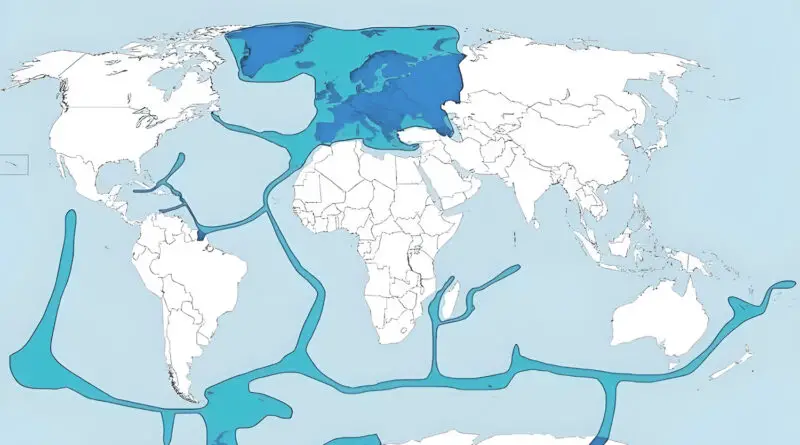
Europe's true extent with overseas territories
Political maps
January 4, 2025 Alex

The ‘Real’ Map of Europe: It’s Bigger Than You Think

Most of us think Europe stops at its continental shores. But did you know that you can find pieces of France in the Pacific and bits of Britain scattered across the globe? Here’s the fascinating story of Europe’s truly global reach.

Read more: The ‘Real’ Map of Europe: It’s Bigger Than You Think →
U.S. Presidential election 2024 (voter-margin + vote total) mapped
NewsPolitical mapsVivid maps
January 2, 2025 Alex

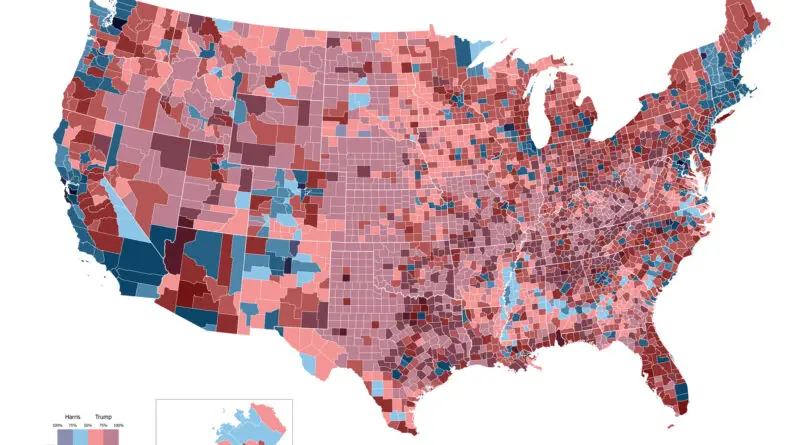
Mapping America’s Rightward Shift: The 2024 Presidential Election County by County

The 2024 election redrew America’s political map, with Trump winning by building surprising coalitions across rural and urban divides. These maps tell the story of an election that defied conventional wisdom.

Read more: Mapping America’s Rightward Shift: The 2024 Presidential Election County by County →
World powers in 1957 mapped
Old maps
December 27, 2024 Alex

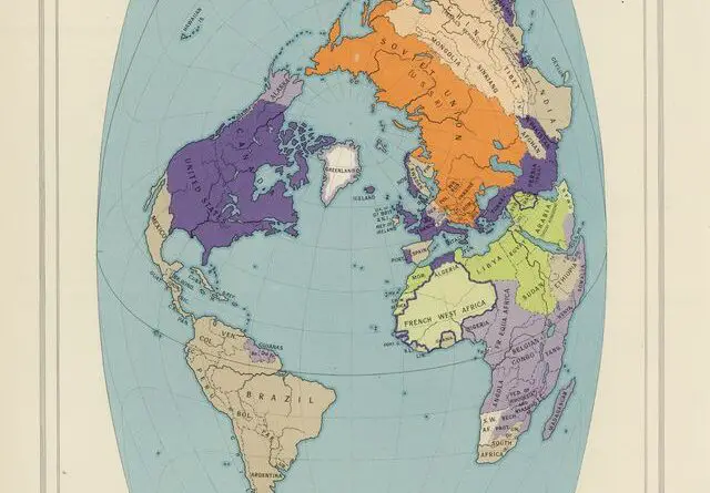
The 1957 Times Atlas Map: A Strategic View of Cold War Alliances

This 1957 Times Atlas map centers on the Atlantic Ocean to highlight NATO countries, revealing Cold War alliances through unconventional projection and strategic coloring.

Read more: The 1957 Times Atlas Map: A Strategic View of Cold War Alliances →
Map of the Drunkest an Driest US Counties
Laws
December 21, 2024 Alex

Exploring America’s Drinking Habits

Explore America’s drinking habits with maps showcasing the drunkest and driest counties, and where alcohol sales are entirely prohibited. Uncover the cultural, religious, and legal influences behind these trends.

Read more: Exploring America’s Drinking Habits →
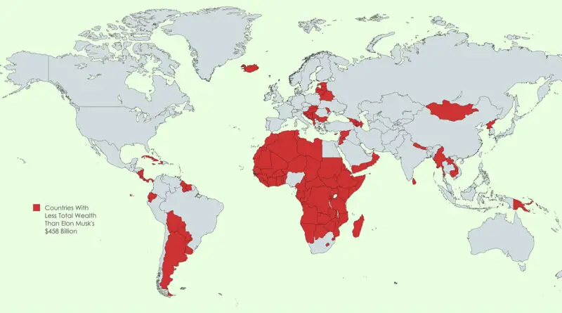
Only 54 Countries Now Have More Household Wealth Than Elon Musk’s $458 Billion (World Map)
Economic maps
December 19, 2024 Alex

Elon Musk’s Wealth: A Fortune Bigger Than Nations

A remarkable visualization shows how Elon Musk’s $458 billion net worth exceeds the total household wealth of numerous countries, reshaping our view of global wealth.

Read more: Elon Musk’s Wealth: A Fortune Bigger Than Nations →
Countries Where New Year’s Day Is Not a Public Holiday
Cultural cartography
December 16, 2024 Alex

Countries Where New Year’s Day Is Not a Public Holiday

Learn why some countries don’t recognize January 1 as a public holiday, along with intriguing New Year’s traditions from around the world.

Read more: Countries Where New Year’s Day Is Not a Public Holiday →
Page 18 of 521« First«...141516171819202122...»Last »

Trending now

  • Human races of the 19th century
    How Has Our View of Human Diversity Changed Since the 19th Century?Oct 22, 2017
  • Spread of the industrial revolution in Europe
    Spread of the Industrial RevolutionSep 11, 2021
  • The “How do I…” question each U.S. state googles more than any other stateJan 28, 2017

Related Products

  • Push pin maps
  • Globe drinks cabinets
  • Maps of the United States
  • Board games
  • Monopoly
  • Map-based strategy board games
  • History Board Games
  • Coloring Books
  • Handheld GPS
  • GPS Watches
  • GPS Trackers

Vivid Maps Tools

  • Convert Latitude/Longitude
  • Elevation Finder
  • Distance Calculator
  • Kilometers to Miles Distance & Length Converter
  • Weight Converter
  • Volume Converter
  • Daylight Comparison
  • Time Zone Converter
  • Antipodes Map
  • Find cities with a similar climate
  • Find cities with a similar climate (2050)
  • How hot cities could be in 2050
  • The U.S. Population Lines

Stay connected

Get the latest maps, insights and updates delivered to your inbox.

Unsubscribe anytime.

VividMaps

Maps that explain the world.

Beautiful, data-rich maps to help you understand our world — its people, places and connections.

Explore

World map World atlas Map posters Globes

Company

About Privacy Contact

Stay connected

Follow us for the latest maps, insights and updates.

Independent WebsiteVirusScanner trust report for vividmaps.com
© 2026 Vivid Maps. All rights reserved.
A more connected world