Australia and Europe comparative map (1950)
This map was prepared by the Royal Australian Survey Corps in the 1950s.
Read more: Australia and Europe comparative map (1950)
This map was prepared by the Royal Australian Survey Corps in the 1950s.
Read more: Australia and Europe comparative map (1950)Purchasing power insights help retailers and manufacturers identify the most profitable regions for trading and promoting their goods. According to
Read more: Map of purchasing power in Europe
Related posts: – Europe is greener now than 100 years ago – European Forest Coverage
Read more: Forest distribution in EuropeYouth development can be achieved even in lowincome countries by providing quality education and training and allowing young people to
Read more: Youth Development Index 2016 (2016)OSM Landuse Landcover is a WebGIS application to explore the OpenStreetMap database specifically in terms of landuse and landcover information.
Read more: OSM Landuse Landcover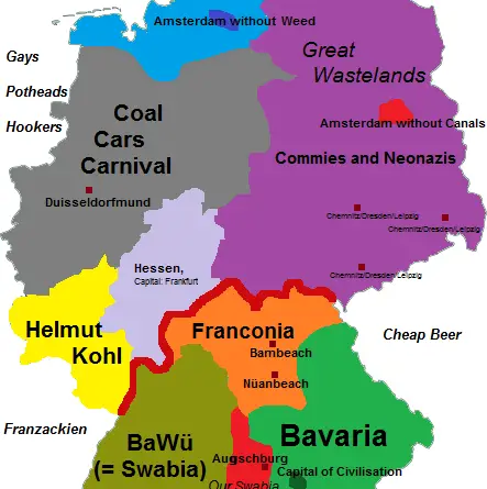
Reddit user: goeie-ouwe-henk
Read more: Stereotypes of the NetherlandsThis map has been created using tree data made available by London’s local authorities and Transport for London. The map
Read more: London Tree MapThe Basel Anti-Money Laundering (AML) Index is an annual ranking assessing country risk regarding money laundering/terrorism financing. It focuses on
Read more: Basel Anti-Money Laundering Index by CountryRelated posts: – An incredible visualisation of global shipping traffic – All the ships in the World ocean – Maritime traffic density around
Read more: A year of Early American Shipping