Skip to content
VividMaps

  • Atlases
  • Map Posters
  • Scratch Maps
  • Globes
  • Videos
3D mapsJobMapping
December 21, 2016 Alex

Unemployed rate in 3D (2015)

Unemployed rate, aged 15 years or older. Via ubilabs.net

Read more: Unemployed rate in 3D (2015) →

Economic mapsWorld
December 20, 2016 Alex

U.S. States renamed for countries with similar GDPs (2015)

Read more: U.S. States renamed for countries with similar GDPs (2015) →
Historical MapsTravel
December 20, 2016 Alex

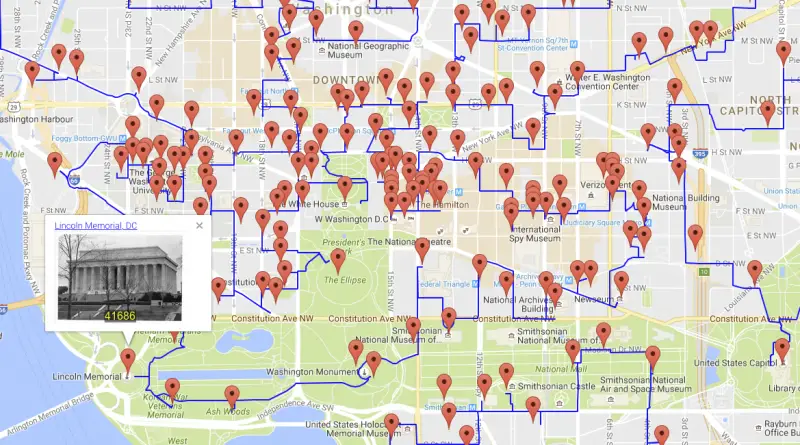
The Shortest-possible historical tour of America

Shortest-possible tour to 50k sites from the National Register of Historic Places. Painting the country with history 217,605-mile walk to

Read more: The Shortest-possible historical tour of America →
Environment mapsPollution
December 20, 2016 Alex

Changes in the Concentration of Nitrogen Dioxide in the U.S. from 2005 to 2014

By Reddit user: crnaruka

Read more: Changes in the Concentration of Nitrogen Dioxide in the U.S. from 2005 to 2014 →
Map ProjectionsSize comparison maps
December 20, 2016 Alex

The Real Size of the World: Maps Have Been Lying to You (But Not on Purpose!)

That world map on your wall? It’s not telling you the whole truth. Here’s why countries aren’t the size you think they are, and what our world actually looks like.

Read more: The Real Size of the World: Maps Have Been Lying to You (But Not on Purpose!) →
Mapping Stereotypes
December 20, 2016 Alex

Tearing the Netherlands apart

The Netherlands means “lower countries” about its low elevation and flat topography, with just approximately 50 percent of its land topping 1 meter (3 feet 3 inches) above sea level and almost 26 percent descending under sea level. The most culmination of the territories below sea level, known as polders, is land reclamation in the 14th century.

Read more: Tearing the Netherlands apart →
Historical MapsVideo
December 19, 2016 Alex

500 Years of European Colonialism: Every year

European colonialism refers to the period of time when European powers established and expanded their empires by acquiring territories in

Read more: 500 Years of European Colonialism: Every year →
PopulationSize comparison maps
December 17, 2016 Alex

Population distribution of the U.S. in units of Canadas

Read more: Population distribution of the U.S. in units of Canadas →
ArcGISNewsPolitical mapsVivid maps
December 16, 2016 Alex

TrumpLand and Clinton Archipelago

Hillary Clinton got nearly 2.9 million more votes than Donald Trump did. Still, Donald Trump called the majority in the Electoral College and won upset victories in the key Rust Belt region. Finally, Donald Trump got 304 electoral votes and Clinton just 227.

Read more: TrumpLand and Clinton Archipelago →
Interactive mapsReal estate
December 16, 2016 Alex

Every eviction case in New York City since 2013

Since 1994, the City Council and state legislature have gradually dismantled legal protections for New York City tenants, giving landlords

Read more: Every eviction case in New York City since 2013 →
Cultural cartographyMappingMarsWeather
December 16, 2016 Alex

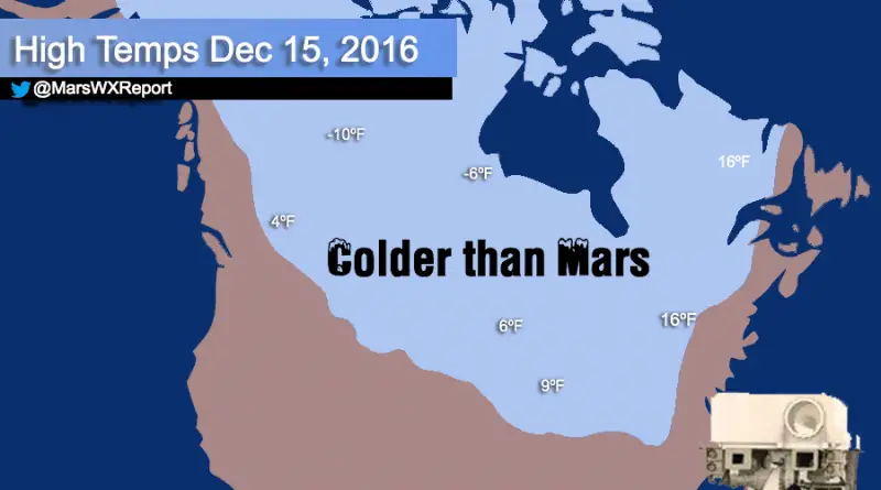
Much of Canada & The upper midwest forecasted to be colder than Mars today

Read more: Much of Canada & The upper midwest forecasted to be colder than Mars today →
Languages
December 16, 2016 Alex

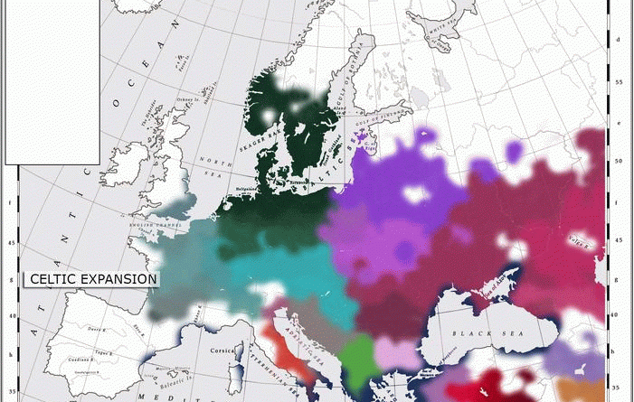
Evolution of Indo-European languages

The evolution of Indo-European languages in Europe reflects the intricate interplay of historical events, cultural exchanges, and the dynamic nature of human communication. It is an ongoing process, with modern languages continuing to adapt and transform, influenced by globalization, technological advancements, and shifting societal norms.

Read more: Evolution of Indo-European languages →
Environment mapsInternetMapping StereotypesPolitical mapsPollution
December 16, 2016 Alex

Random states of America

This interactive map creates randomly-generated state boundaries for the United States, and see who would recent presidential elections under the

Read more: Random states of America →
Page 203 of 521« First«...199200201202203204205206207...»Last »

Trending now

  • Soviet detailed map
    Detailed Cold War-era Soviet military map of the San Francisco Bay area (1980)Oct 22, 2017
  • World map of Y-DNA Haplogroups
    World map of Y-DNA HaplogroupsMay 17, 2017
  • Maps of differences between East and West Germany
    Germany is still divided by east and westSep 11, 2020

Related Products

  • Push pin maps
  • Globe drinks cabinets
  • Maps of the United States
  • Board games
  • Monopoly
  • Map-based strategy board games
  • History Board Games
  • Coloring Books
  • Handheld GPS
  • GPS Watches
  • GPS Trackers

Vivid Maps Tools

  • Convert Latitude/Longitude
  • Elevation Finder
  • Distance Calculator
  • Kilometers to Miles Distance & Length Converter
  • Weight Converter
  • Volume Converter
  • Daylight Comparison
  • Time Zone Converter
  • Antipodes Map
  • Find cities with a similar climate
  • Find cities with a similar climate (2050)
  • How hot cities could be in 2050
  • The U.S. Population Lines

Stay connected

Get the latest maps, insights and updates delivered to your inbox.

Unsubscribe anytime.

VividMaps

Maps that explain the world.

Beautiful, data-rich maps to help you understand our world — its people, places and connections.

Explore

World map World atlas Map posters Globes

Company

About Privacy Contact

Stay connected

Follow us for the latest maps, insights and updates.

Independent WebsiteVirusScanner trust report for vividmaps.com
© 2026 Vivid Maps. All rights reserved.
A more connected world