Skip to content
VividMaps

  • Atlases
  • Map Posters
  • Scratch Maps
  • Globes
  • Videos
World
March 26, 2016 Alex

Beyond the sea

When you stare out into the ocean, what’s on the other side? Finding the answer isn’t as simple as drawing

Read more: Beyond the sea →

Interactive mapsMapping HealthWorld
March 25, 2016 Alex

Health Care Index 2016

Health care  is the maintenance or improvement of health via the diagnosis, treatment, and prevention of disease, illness, injury, and

Read more: Health Care Index 2016 →
Natural disastersResources
March 25, 2016 Alex

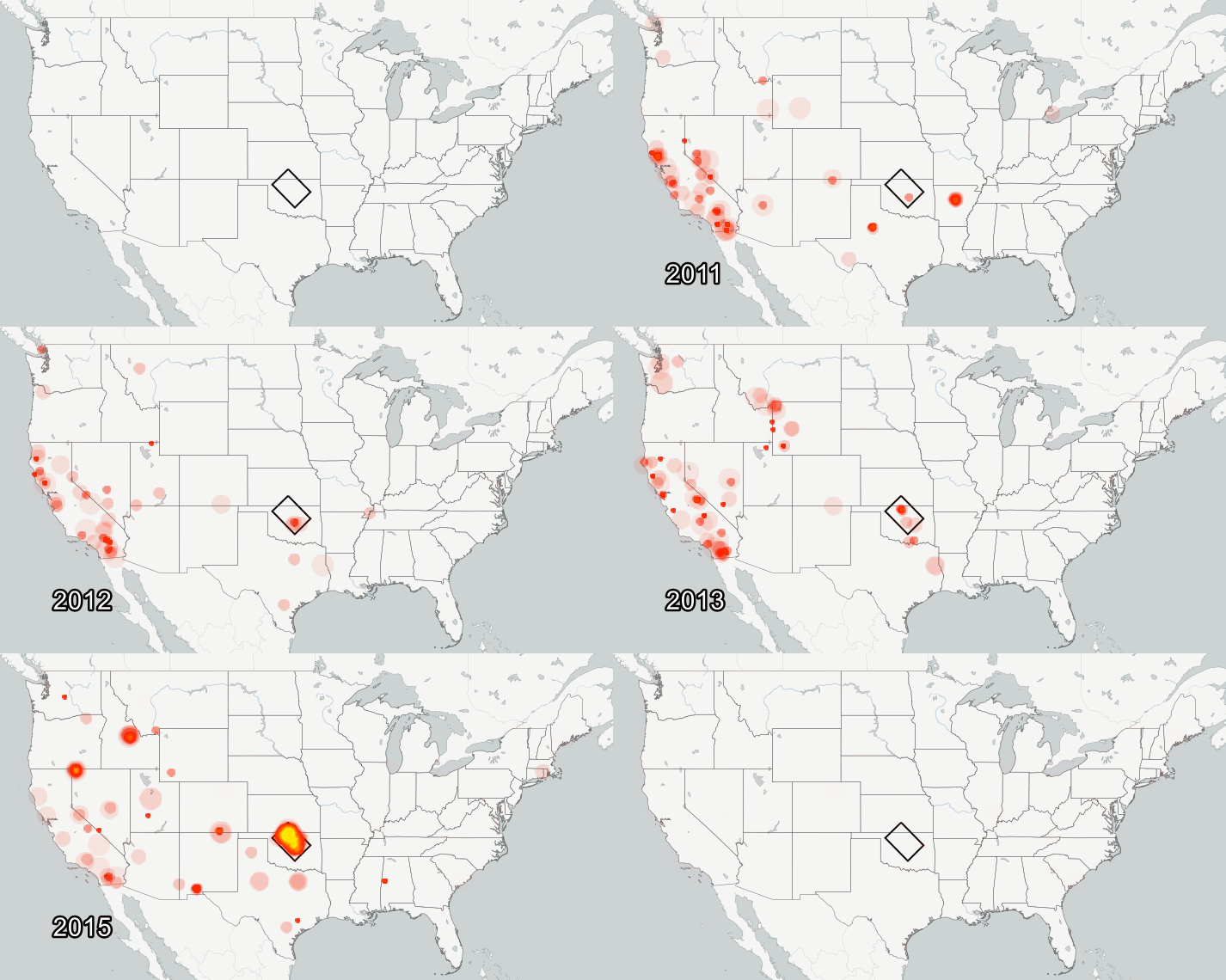
Oklahoma has become the earthquake capital of the US

Last year the U.S. Geological Survey released a flurry of reports on the topic of human-induced earthquakes. It is now

Read more: Oklahoma has become the earthquake capital of the US →
Population
March 25, 2016 Alex

The U.S. Population Is Swelling in Almost Every State

Does the subway/freeway/Shake Shack line feel a little more crowded than it did a year ago? It might not be

Read more: The U.S. Population Is Swelling in Almost Every State →
Alternate History
March 25, 2016 Alex

If every proposed state in the USA was accepted

There are 50 states in the U.S., which means about fifty unique stories reveal how every state got its shape. 

Read more: If every proposed state in the USA was accepted →
CitiesInfographicsReal estateTechnology
March 25, 2016 Alex

The global smart cities outlook: Opportunities and challenges

As cities worldwide make use of information and communication technologies to better deliver services and create efficiencies, they must find

Read more: The global smart cities outlook: Opportunities and challenges →
Environment maps
March 25, 2016 Alex

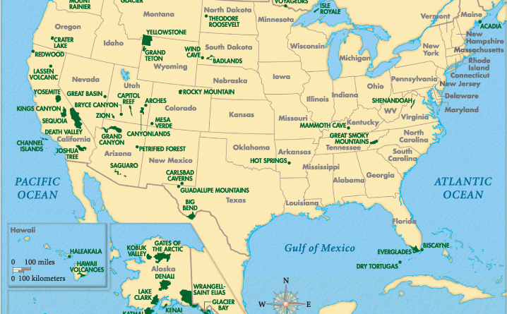
North America’s Natural Treasures

Tree cover of North America Map of protected areas in North America National Parks of Canada National Parks in the

Read more: North America’s Natural Treasures →
CitiesInteractive mapsMapping StereotypesPollutionSliderVideo
March 25, 2016 Alex

Chatty Maps

Urban sound has a huge influence over how we perceive places. Yet, city planning is concerned mainly with noise, simply

Read more: Chatty Maps →
BusinessCulinaryMappingMapping Stereotypes
March 25, 2016 Alex

IHOP vs. Waffle House

Read more: IHOP vs. Waffle House →
Economic mapsWorld
March 25, 2016 Alex

Change in GDP per capita from 2008 before crisis to 2015

Read more: Change in GDP per capita from 2008 before crisis to 2015 →
Environment mapsHistorical MapsInternetOld maps
March 25, 2016 Alex

Map of River Thames showing comparative range of naval guns firing upon London (Illustrated London News, 24 July 1909)

Read more: Map of River Thames showing comparative range of naval guns firing upon London (Illustrated London News, 24 July 1909) →
Historical Maps
March 25, 2016 Alex

Eastern Bloc Area Border Changes from 1938 to 1948

From 1938 to 1948, the Eastern Bloc area witnessed significant border changes, largely driven by the complex geopolitical dynamics of World War II and the immediate aftermath. The Eastern Bloc, comprising countries in Eastern and Central Europe, was under the influence of the Soviet Union during this period.

Read more: Eastern Bloc Area Border Changes from 1938 to 1948 →
BusinessGoogleInternetPolitical mapsPopulationSlider
March 24, 2016 Alex

What company each state googles more than any other

Read more: What company each state googles more than any other →
Page 320 of 521« First«...316317318319320321322323324...»Last »

Trending now

  • Steel production in 1800 mapped
    220 Years of Steel Production, Mapped From 1800 to 2025Oct 18, 2026
  • Best Value Mobile Data World Map
    Maps reveal what countries have the most affordable mobile dataAug 9, 2021
  • Stereotypes about the United States
    The stereotype map of every US StateOct 29, 2015

Related Products

  • Push pin maps
  • Globe drinks cabinets
  • Maps of the United States
  • Board games
  • Monopoly
  • Map-based strategy board games
  • History Board Games
  • Coloring Books
  • Handheld GPS
  • GPS Watches
  • GPS Trackers

Vivid Maps Tools

  • Convert Latitude/Longitude
  • Elevation Finder
  • Distance Calculator
  • Kilometers to Miles Distance & Length Converter
  • Weight Converter
  • Volume Converter
  • Daylight Comparison
  • Time Zone Converter
  • Antipodes Map
  • Find cities with a similar climate
  • Find cities with a similar climate (2050)
  • How hot cities could be in 2050
  • The U.S. Population Lines

Stay connected

Get the latest maps, insights and updates delivered to your inbox.

Unsubscribe anytime.

VividMaps

Maps that explain the world.

Beautiful, data-rich maps to help you understand our world — its people, places and connections.

Explore

World map World atlas Map posters Globes

Company

About Privacy Contact

Stay connected

Follow us for the latest maps, insights and updates.

Independent WebsiteVirusScanner trust report for vividmaps.com
© 2026 Vivid Maps. All rights reserved.
A more connected world